By Matt Noone
I moved to Madison, Wisconsin, in 2013 and began working in the Forest Landscape Ecology Lab within the Forest Ecology and Management Department (Now Forest and Wildlife Ecology) at the University of Wisconsin-Madison. Through this experience, I gained a deep appreciation for the Wisconsin landscape and an understanding of historical ecology. I was responsible for running a computer mapping lab where a 1930s historical forest inventory was converted to a digital Geographic Information System (GIS) database.
That old data was from a project called the Wisconsin Land Economic Inventory, also referred to as the Bordner Survey after its director, John Bordner. The survey was initiated at a time of peak land clearing and degradation in Wisconsin, and it is likely the most detailed inventory of land use ever carried out anywhere. In 2019 I took on a new role as GIS Specialist at the Capital Area Regional Planning Commission, a public agency focused on land use and natural systems protection in Dane County, but I was able to maintain my connections with the digitization project I’d started at the Forest Landscape Ecology Lab. The Bordner Survey digitization was completed in 2025. It took ten years and contributions from more than two hundred students.
It was through my work with the Bordner Survey data that I learned to give the oak genus the respect it so rightfully deserves. Wisconsin’s forested landscape was novel to me, and the Bordner data helped me see how it has changed over time, often to the detriment of the oaks. At the time of European American settlement in the 1830s, Dane County was characterized predominantly by bur oak (Q. macrocarpa) and white oak (Q. alba) savanna or oak woodland, with some open prairies.
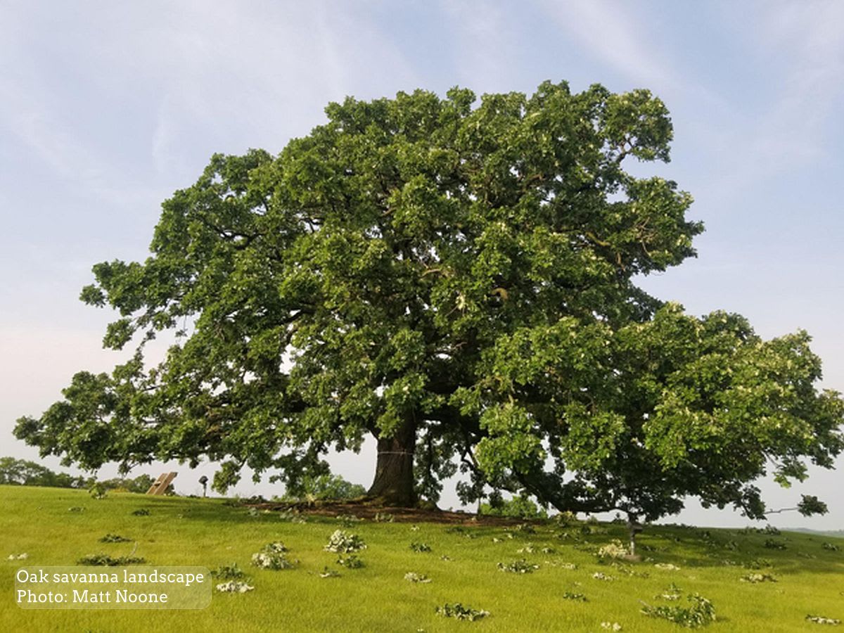
The oak savanna was best described as majestic, populated with prairie grasses, forbs (herbaceous flowering plants) and broadly dispersed oaks with crown diameters of up to one hundred feet; the oaks were often far wider than tall. Five mature bur oaks, spaced apart, could blanket a single acre with canopy. Tree densities across the county were typically less than twenty trees per acre. The oaks represented a keystone ecological species, which hundreds of other species depended on. Historically, there were also mesic (environments with a balanced supply of water) species such as sugar maple, boxelder, hackberry, basswood and elm present, although these species were narrowly confined to riparian areas where the waterway offered some protection from wildfire.
All Wisconsin oak species have intermediate to low shade tolerance. This means they will only thrive and regenerate when light competition from adjacent competing vegetation and trees is eliminated. The frequent fire regime maintained by indigenous Native Americans for thousands of years enabled these oak species to dominate the landscape, as the oaks could survive grass fires while other species could not. European American settlers removed wild land fires from the landscape, enabling tree densities to increase and favoring the mesic, shade-tolerant species not adapted to fire. New oak trees struggled to compete, in many places leaving only the pre-settlement specimens to remind us of the landscape once known in southern Wisconsin.
Interestingly enough, it appears the urban environment has provided our relic oaks with a repose, allowing them to exist and thrive on our city streets, parks, and backyards without the same landscape pressures from agriculture or competing sunlight in the closed forest environment. Of course, these urban oaks face other challenges, including soil compaction, root damage and removal during construction of buildings and infrastructure. Yet they survive here because we value and often work to protect them. In Dane County, the best opportunity to witness these living artifacts is in our cities, villages and parks.
Oaks tend to be the oldest trees in the contemporary landscape, often surpassing two hundred years of age. In 2022, I became aware of a historic inventory of the largest and oldest trees in Madison. Walter Scott, a renowned conservationist with the Wisconsin Department of Conservation (later the Wisconsin Department of Natural Resources) decided to inventory these trees in 1976. His goal was to celebrate the bicentennial of America's independence by documenting “heritage” trees that had been present on the landscape during our nation's conception.
All oak trees estimated to be two hundred years or older (ten-foot circumference for white oaks and eleven-foot circumference for red oaks) within eight miles of the State Capitol were identified, measured and mapped. The efforts were published in the Capital Times, requiring several reprintings due to popular demand. Twenty-five years later, in 2001, these same trees were revisited and measured by UW-Madison Professor Bruce Allison. In this second heritage oak inventory the trees’ spatial location coordinates were also recorded.
As new anniversaries approached – 250 years for the country and fifty years for the Heritage Oak Inventory – I wondered who would renew the project again. I had taken on a volunteer role as Chair of the Dane County Tree Board and was reflecting on my personal history as a Big Tree Hunter. I looked around, compared notes with my tree-loving colleagues across the region, and realized the baton was mine to pick up.
We thereby launched the Heritage Oak Project. Equipped with satellite imagery, GPS tracking, camera phones and computer mapping, we had many advantages with this third round of the inventory. The time-consuming efforts to relocate the trees, contact landowners, or sort through new developments and road name changes were a thing of the past. Aerial photo mosaics were available for each decade, dating back to 1937. With a click, I could get the exact location coordinates of each tree on my phone.
I created a user-friendly crowd-sourced web mapping application that allowed anyone interested in verifying a tree to remeasure, upload photographs and tell a story about that tree. Previously unidentified heritage oaks could be added to the map, and we expanded the focus area beyond the original eight-mile radius from the capitol to include the entire county. Over eighty community members contributed to identifying over four hundred of these heritage trees.